Uphill
378m

Length
7km
Duration
3h
Elev gain
378m
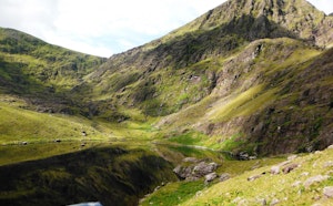
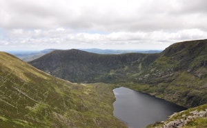
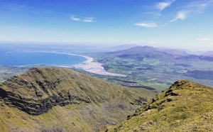
This is a great there-and-back hike to the Strickeen Mountain in County Kerry. The trail follows the road initially and then follows a rocky and grassy track to the top, with some sheep roaming around. The incline is moderate and steady throughout making it a nice effort. The views are lovely and open on the valley and the Black Lake in the distance. This is a great hike for the whole family!

Already more than 200,000 users!
Uphill
378m
Highest point
417m
Downhill
378m
Lowest point
45m
Route type
There and back
Download the map on your smartphone to save battery and rest assured to always keep access to the route, even without signal.
Includes IGN France and Swisstopo.
I indicate whether dogs are allowed or prohibited on this trail
All year
0 ratings
Also enjoy:

Already more than 200,000 users!