Uphill
746m

Length
10km
Duration
5h
Elev gain
746m
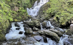
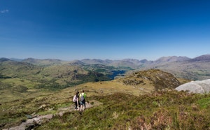
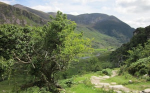
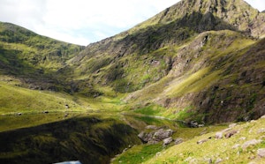
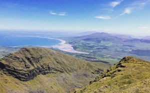
Discover this challenging loop around the Devil’s Punchbowl following the Gortagullane River in County Kerry. The trail is steep with a constant gradient, gaining 700 metres of altitude in just over four kilometres. The track is grassy and rocky but well maintained, it can get a little muddy and slippery in times of rain. The views are magnificent with the Devil’s Punchbowl in the foreground and mountains in the distance.

Already more than 200,000 users!
Uphill
746m
Highest point
884m
Downhill
746m
Lowest point
131m
Route type
There and back
Download the map on your smartphone to save battery and rest assured to always keep access to the route, even without signal.
Includes IGN France and Swisstopo.
I indicate whether dogs are allowed or prohibited on this trail
All year
1 rating
Also enjoy:

Already more than 200,000 users!