Uphill
746m

Length
8km
Duration
5h
Elev gain
746m
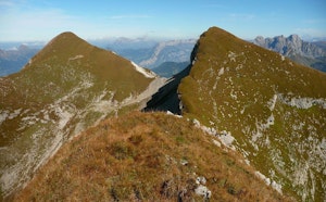
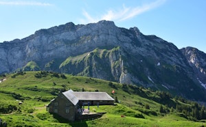
After a relatively steep start, this hike continues to gain height until you reach the first summit of this route, the Hirzli (1,640 m). The trail then continues along the crest to Planggenstock, the second peak, 35 meters higher. Here, the views are splendid and the efforts are rewarded. You then have to go back down until you reach the starting point.

Already more than 200,000 users!
Uphill
746m
Highest point
1632m
Downhill
746m
Lowest point
983m
Route type
Loop
Download the map on your smartphone to save battery and rest assured to always keep access to the route, even without signal.
Includes IGN France and Swisstopo.
I indicate whether dogs are allowed or prohibited on this trail
From May to October
0 ratings
Also enjoy:

Already more than 200,000 users!