Uphill
1027m

Length
13km
Duration
7h
Elev gain
1027m
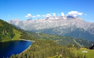
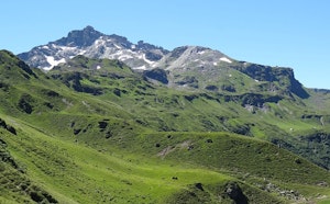
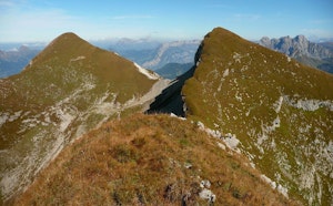
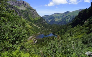
Departing from the Bärenboden cable car, this hike makes a superb loop over many peaks. Indeed, the route passes through the Siwellen before joining the Schilt and the Tristli, located at nearly 2,300 meters above sea level. It then returns via the Schwarzstöckli and the Heustockfurggel, before reaching the starting point. The incredible views follow one another throughout the ride.

Already more than 200,000 users!
Uphill
1027m
Highest point
2358m
Downhill
1027m
Lowest point
1444m
Route type
Loop
Download the map on your smartphone to save battery and rest assured to always keep access to the route, even without signal.
Includes IGN France and Swisstopo.
I indicate whether dogs are allowed or prohibited on this trail
From May to September
0 ratings
Also enjoy:

Already more than 200,000 users!