Uphill
427m
Length
9km
Duration
3h30min
Elev gain
427m
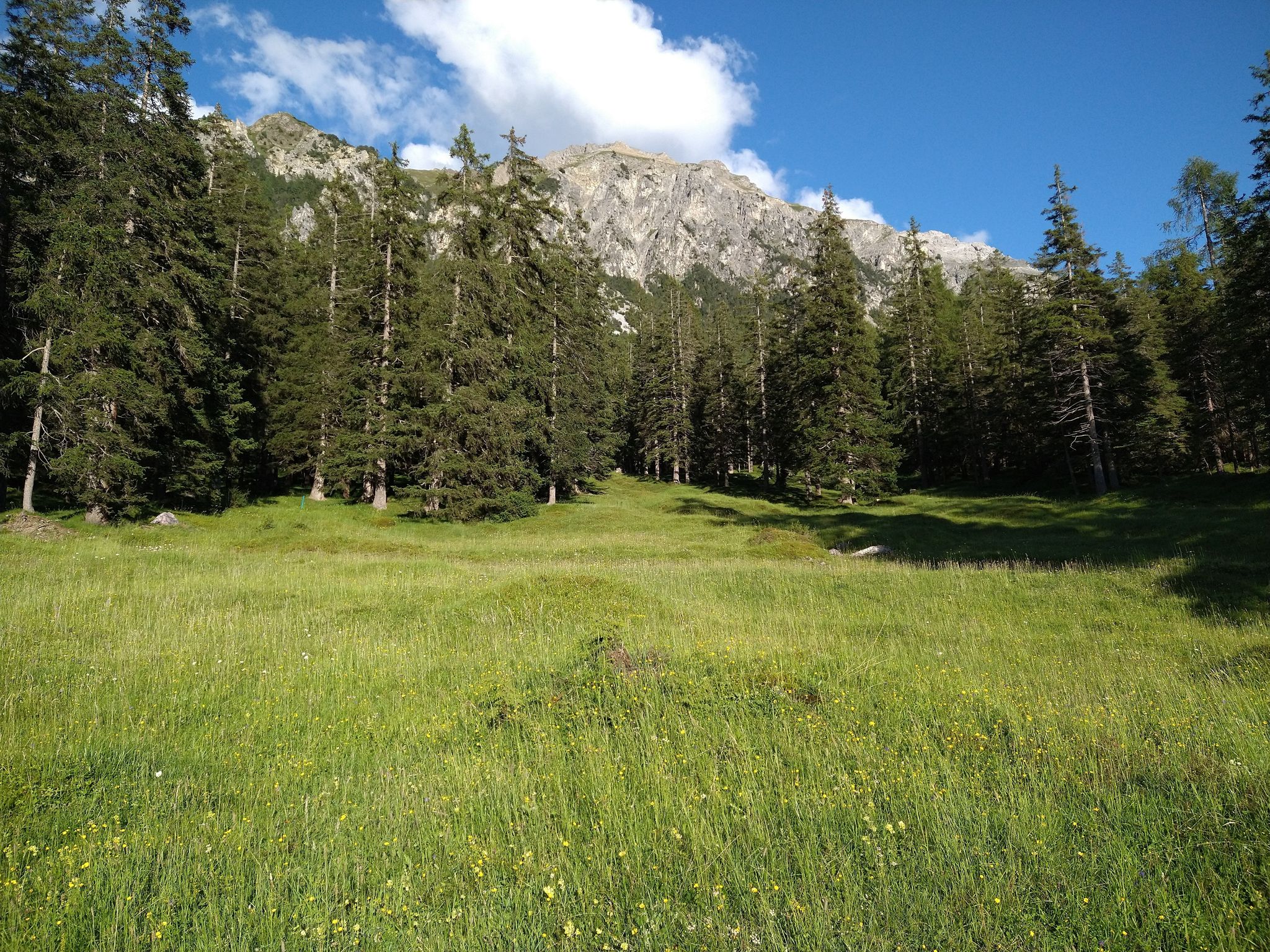
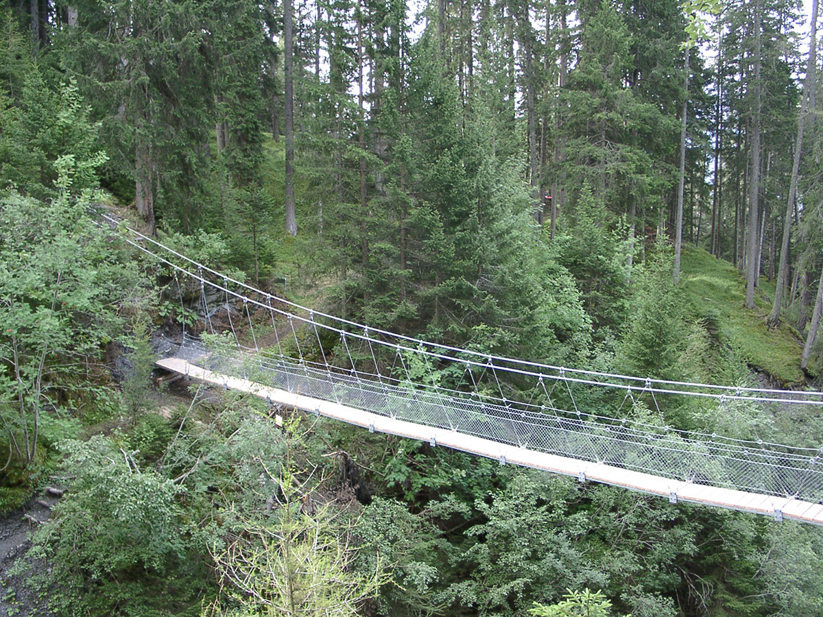
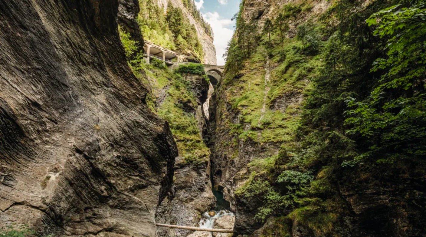
Departing from Thusis station, this walk explores the Viamala gorges. The route is pleasant and is done in a splendid natural setting.
Note that by continuing to the south of our route, it is possible to reach a reception center to discover the gorges, the visit of which is not free.

Already more than 200,000 users!
Uphill
427m
Highest point
989m
Downhill
427m
Lowest point
702m
Route type
Loop
Download the map on your smartphone to save battery and rest assured to always keep access to the route, even without signal.
Includes IGN France and Swisstopo.
I indicate whether dogs are allowed or prohibited on this trail
Can be difficult in Winter
3 ratings
Je ne recommande pas du tout..les gorges ,au final on ne les voit casiment pas..Le seul passage bien est dans la forêt, mais il ne faut pas avoir le vertige et avoir le pied sûr. De l'autre côté , ce n'est que de la route. Le seul point positif ,c'est de pouvoir se baigner à la fin. Mais pour les gorges, passez votre chemin
Also enjoy:

Already more than 200,000 users!