Uphill
456m
France > Auvergne-Rhône-Alpes > Drôme > Vercors Regional Natural Park
Length
8km
Duration
3h30min
Elev gain
456m
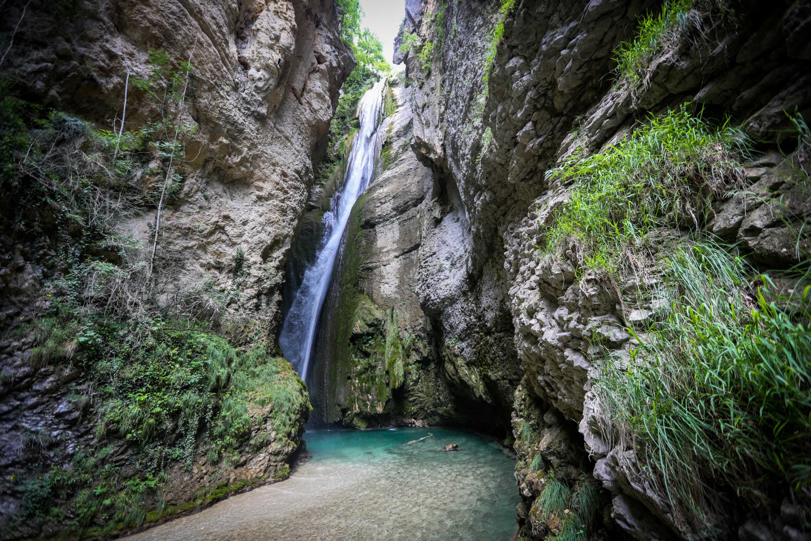
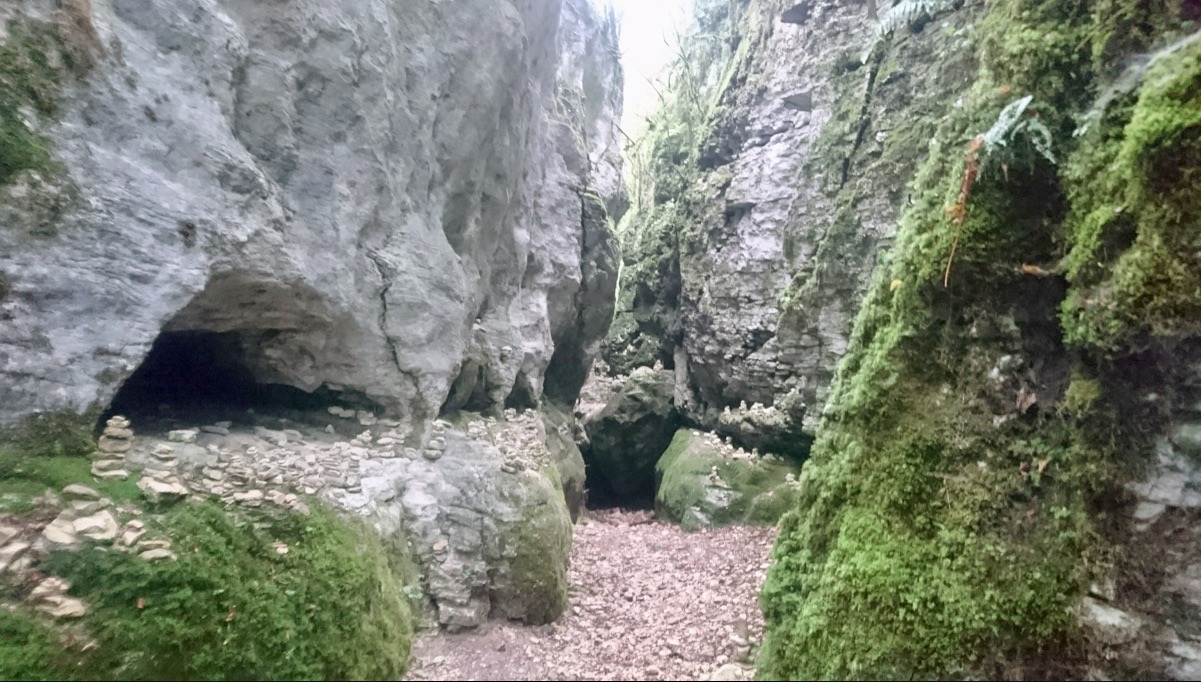
This dark and narrow canyon, between two cliffs, offers a refreshing setting appreciated during the summer. And the scenery is total, with the presence of boulders, lichens and ferns.

Already more than 200,000 users!
Uphill
456m
Highest point
1012m
Downhill
456m
Lowest point
616m
Route type
Loop
Download the map on your smartphone to save battery and rest assured to always keep access to the route, even without signal.
Includes IGN France and Swisstopo.
I indicate whether dogs are allowed or prohibited on this trail
All year
2 ratings
Très belle et agréable randonnée à l’ombre. Deux endroits un peu étroits où l’on doit s’aider de cordes mais cela vaut le détour.
Also enjoy:

Already more than 200,000 users!