Uphill
609m
France > Auvergne-Rhône-Alpes > Haute-Savoie > Massif des Bauges Regional Natural Park
Length
8km
Duration
4h30min
Elev gain
609m
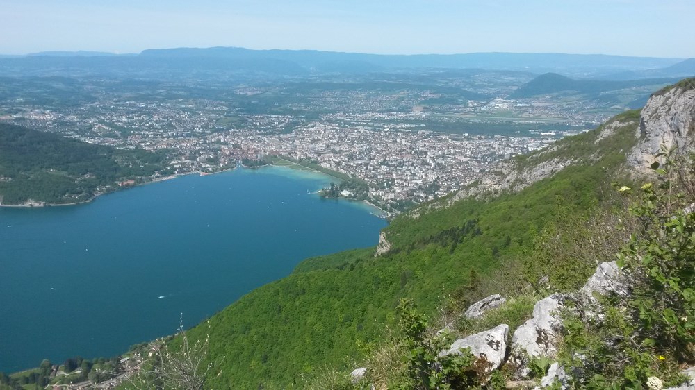
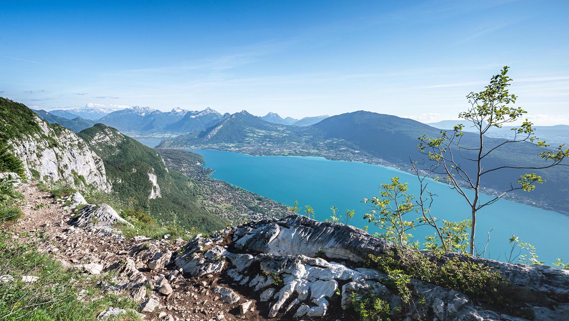
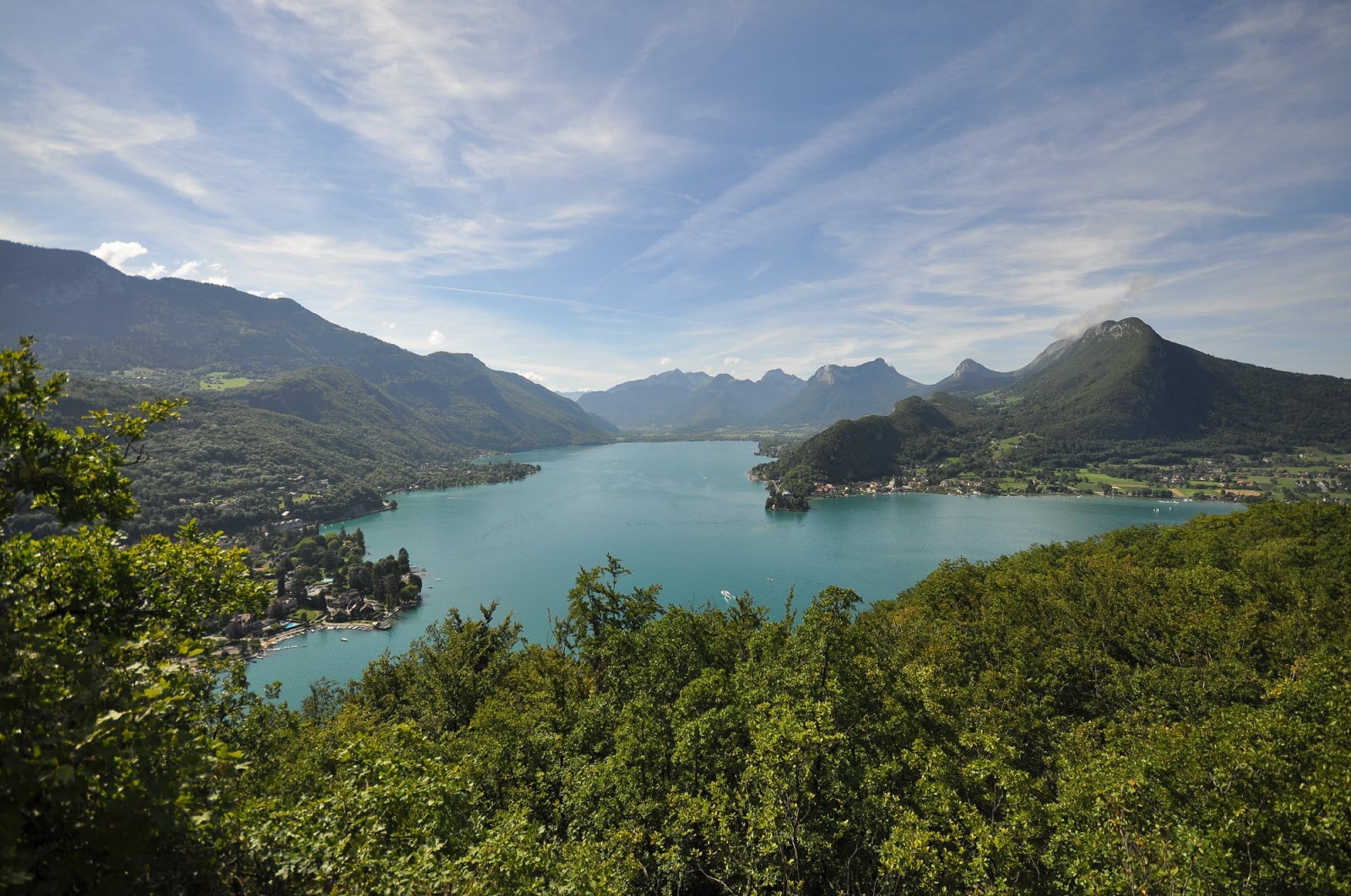
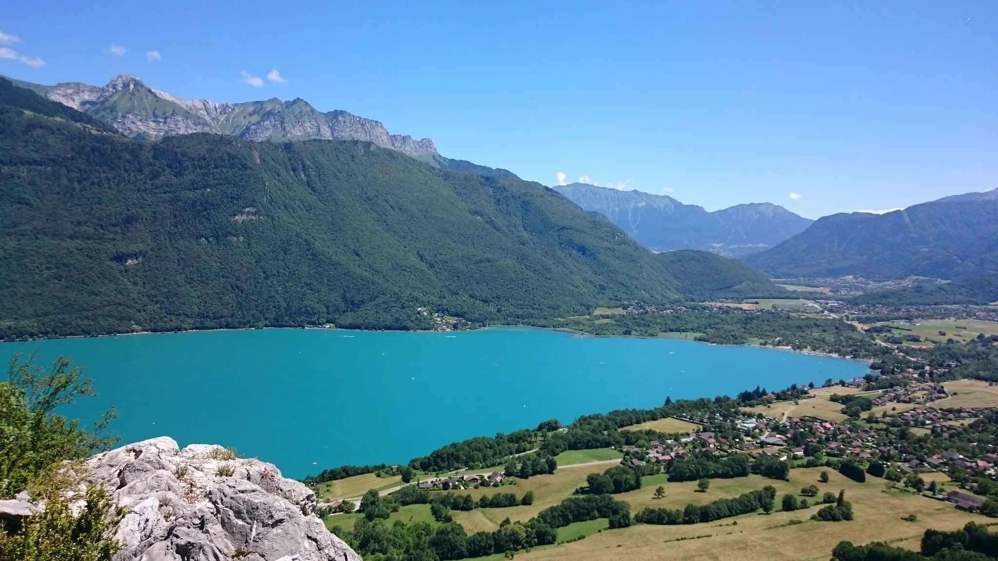
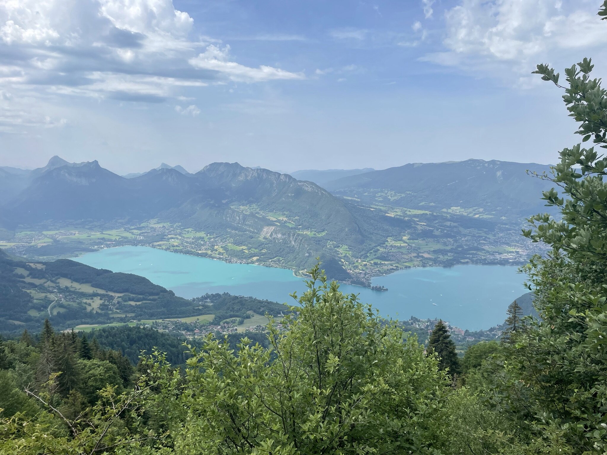
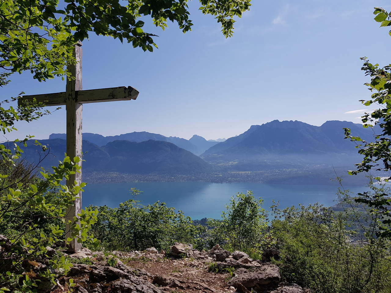
Return trip to the Croix des Cessenaz to enjoy a beautiful view of Lake Annecy. The trail runs through the Semnoz massif, whose wooded profile overlooks the city of Annecy.

Already more than 200,000 users!
Uphill
609m
Highest point
1000m
Downhill
609m
Lowest point
462m
Route type
There and back
Download the map on your smartphone to save battery and rest assured to always keep access to the route, even without signal.
Includes IGN France and Swisstopo.
I indicate whether dogs are allowed or prohibited on this trail
Can be difficult in Winter
1 rating
Also enjoy:

Already more than 200,000 users!