Uphill
1030m
Length
12km
Duration
7h
Elev gain
1030m
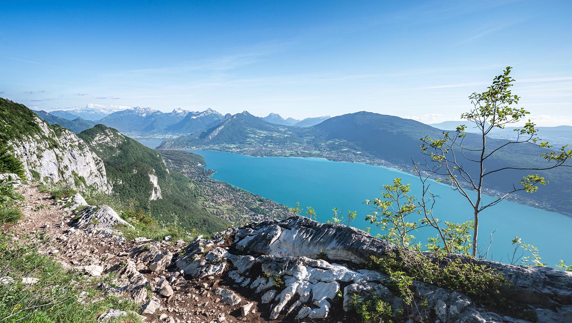
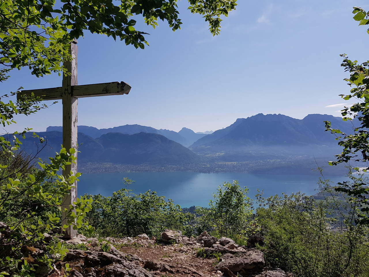
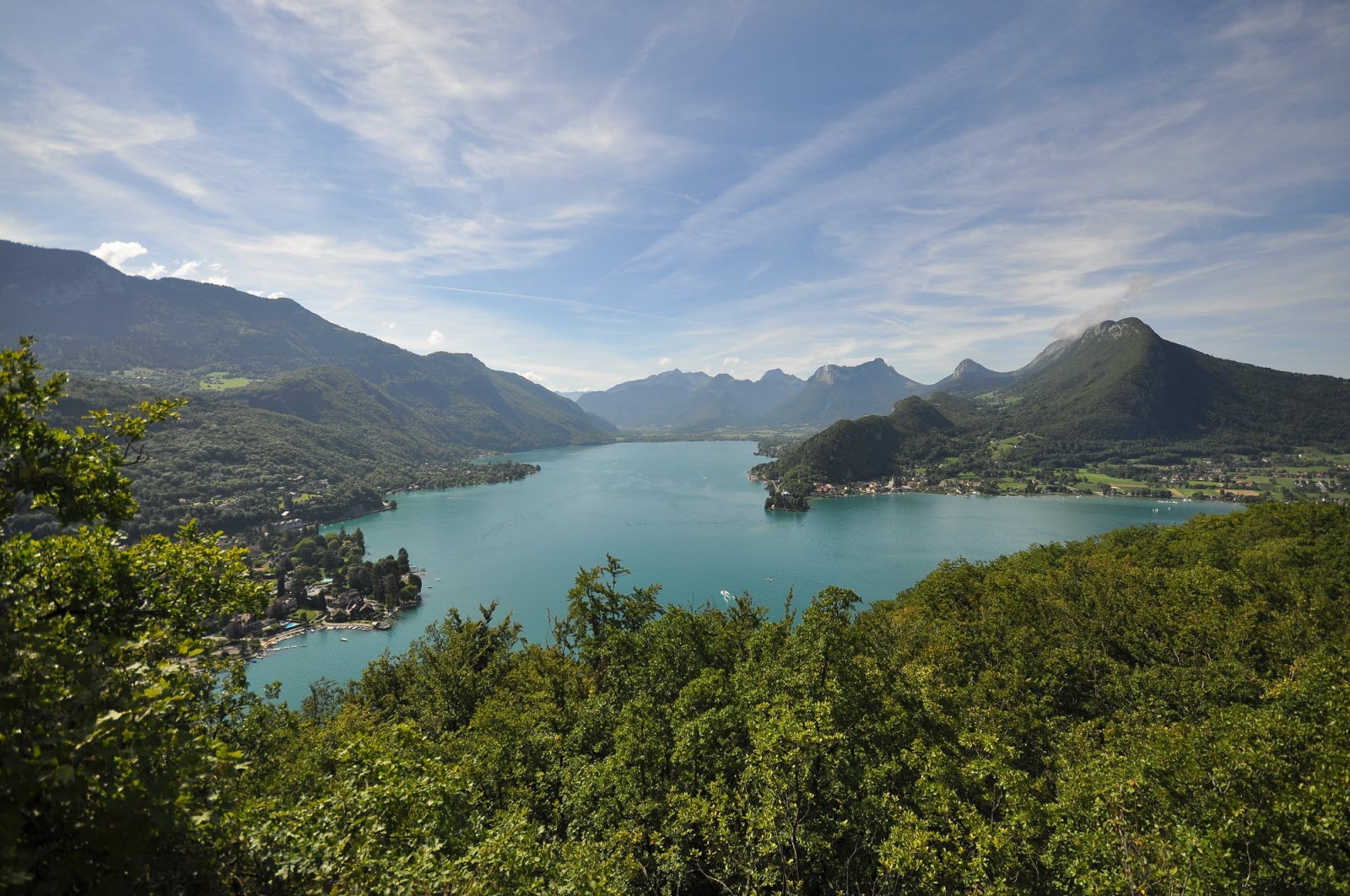
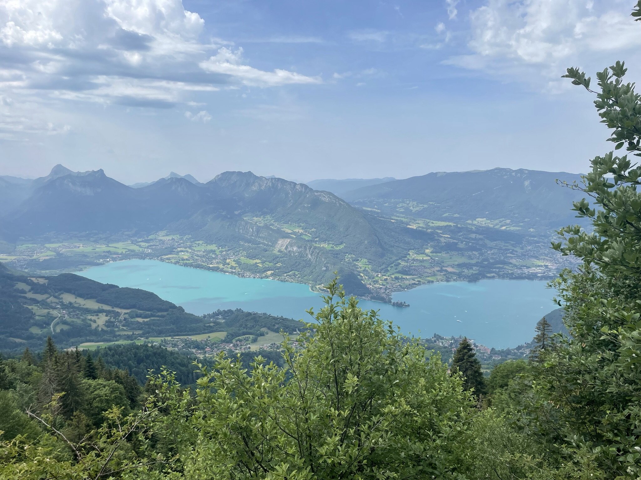
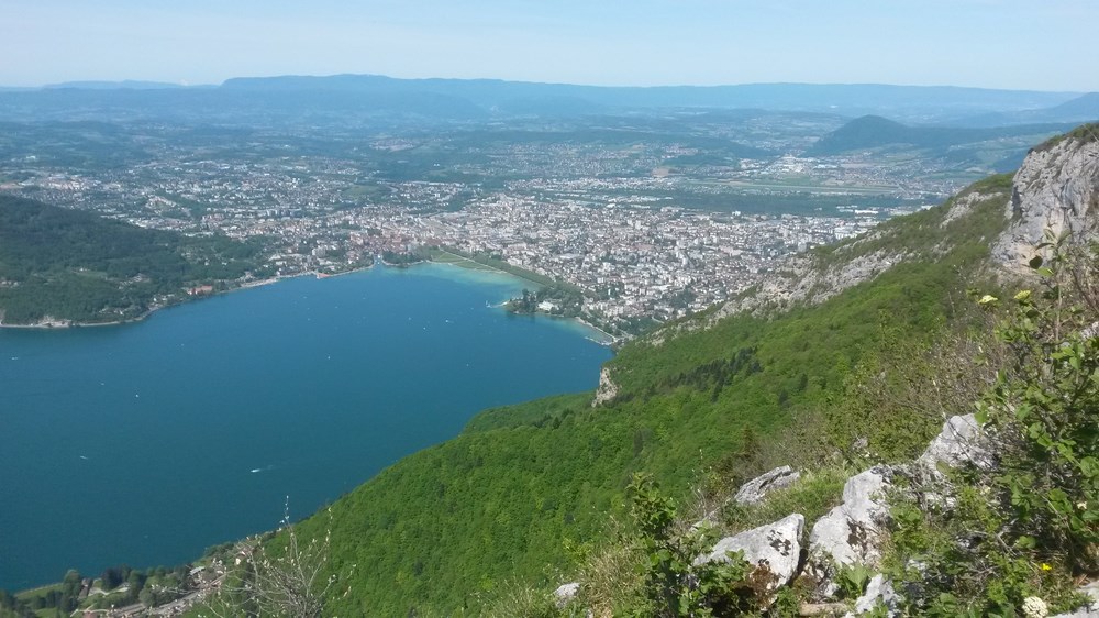
Easily accessible from Annecy, this trail winds through verdant forests before reaching the summit. Once up there, you will be rewarded with a breathtaking panorama of Lake Annecy.

Already more than 200,000 users!
Uphill
1030m
Highest point
1285m
Downhill
1030m
Lowest point
455m
Route type
Loop
Download the map on your smartphone to save battery and rest assured to always keep access to the route, even without signal.
Includes IGN France and Swisstopo.
I indicate whether dogs are allowed or prohibited on this trail
Can be difficult in Winter
7 ratings
Also enjoy:

Already more than 200,000 users!