Uphill
634m
France > Auvergne-Rhône-Alpes > Isère > Chartreuse Regional Natural Park
Length
7km
Duration
4h30min
Elev gain
634m
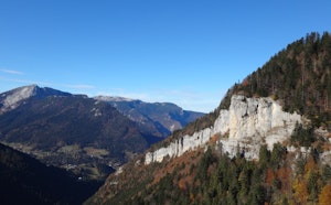
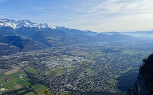
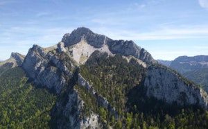
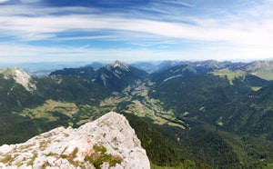
Dent de Crolles is a classic of the Chartreuse, being the second highest peak in the massif after Chamechaude. Its ridges offer a magnificent panorama of the surrounding mountains, after a fairly sporty ascent. The ascent is via the Trou du Glaz and the descent via the Pas de l'Oeille.

Already more than 200,000 users!
Uphill
634m
Highest point
2027m
Downhill
634m
Lowest point
1406m
Route type
Loop
Download the map on your smartphone to save battery and rest assured to always keep access to the route, even without signal.
Includes IGN France and Swisstopo.
6 ratings
Super rando effectuée à l’été 2022. La montée est assez abrupte, et on a croisé un patou (très calme) sur le chemin.
La vue au sommet est sensationnelle, jusqu’au Mont Blanc. Idéal pour un pique-nique bien qu’un peu venteux.
Descente technique, déconseillée si sujet à vertiges - échelles, précipices. Ça reste abordable pour un randonneur en forme.
Also enjoy:

Already more than 200,000 users!