Uphill
119m
France > Grand Est > Haut-Rhin > Ballons des Vosges Regional Natural Park
Length
2km
Duration
1h
Elev gain
119m
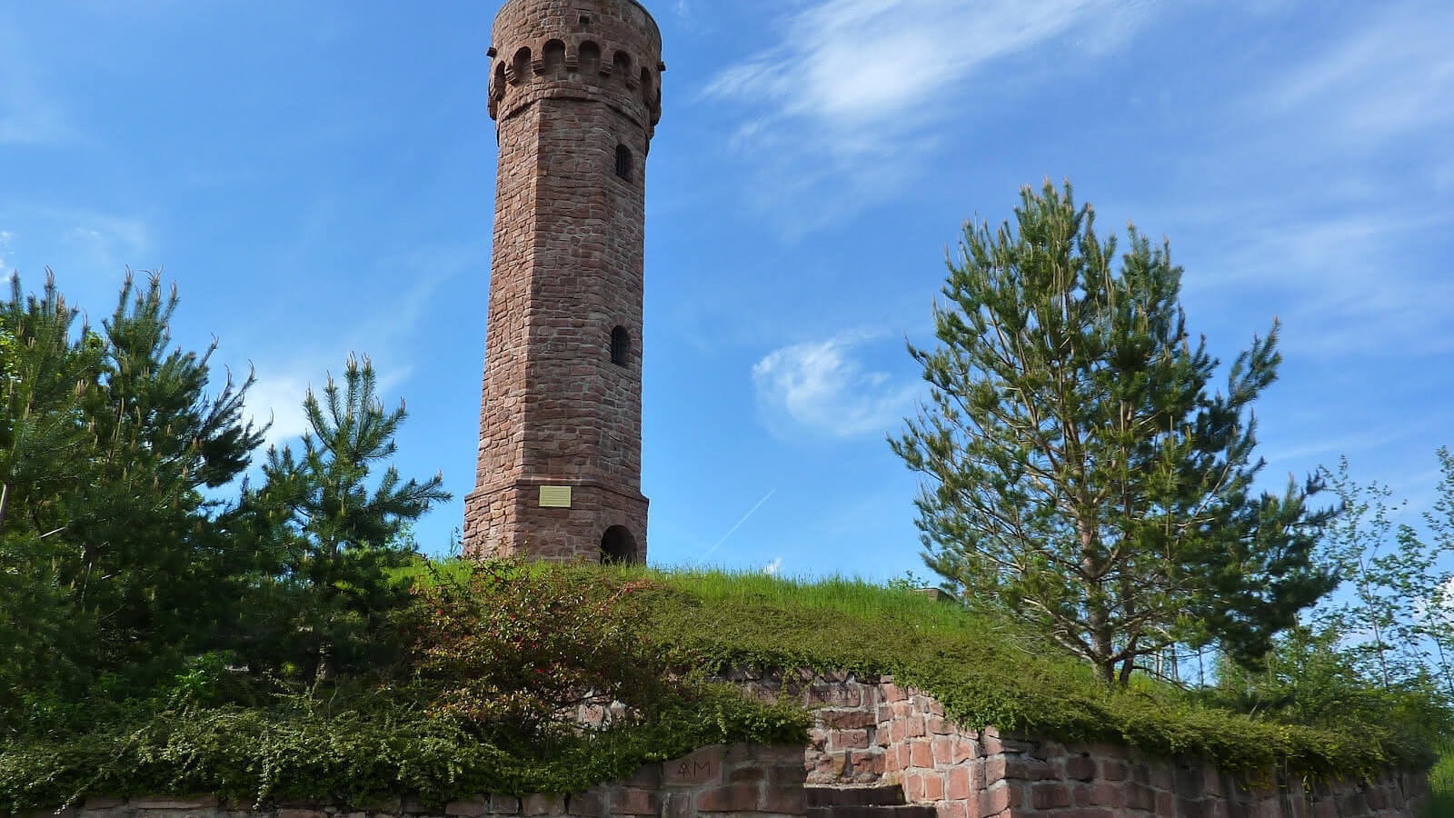
Easy round trip to the charming Tour du Faudé, which was destroyed during the Second World War and rebuilt at the start of the 20th century. Once at the top, the 360° view of the Pays de Welche and its surroundings is spectacular.

Already more than 200,000 users!
Uphill
119m
Highest point
771m
Downhill
119m
Lowest point
655m
Route type
There and back
Download the map on your smartphone to save battery and rest assured to always keep access to the route, even without signal.
Includes IGN France and Swisstopo.
I indicate whether dogs are allowed or prohibited on this trail
All year
0 ratings
Also enjoy:

Already more than 200,000 users!


