Uphill
555m
Length
13km
Duration
5h
Elev gain
555m
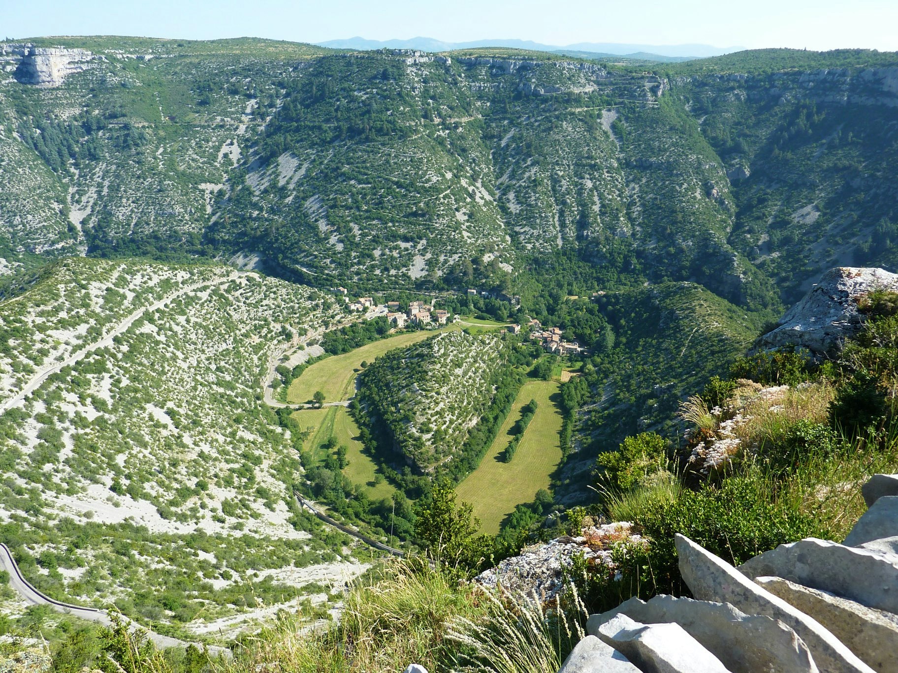
Departing from the Navacelles tourist office, this trail allows you to discover the circus of the same name, descending into the gorges of the Vis to the Moulin de la Foux. A superb outing combining grandiose landscapes, village of yesteryear and viewpoints.

Already more than 200,000 users!
Uphill
555m
Highest point
620m
Downhill
555m
Lowest point
324m
Route type
Loop
Download the map on your smartphone to save battery and rest assured to always keep access to the route, even without signal.
Includes IGN France and Swisstopo.
I indicate whether dogs are allowed or prohibited on this trail
All year
5 ratings
Also enjoy:

Already more than 200,000 users!


